


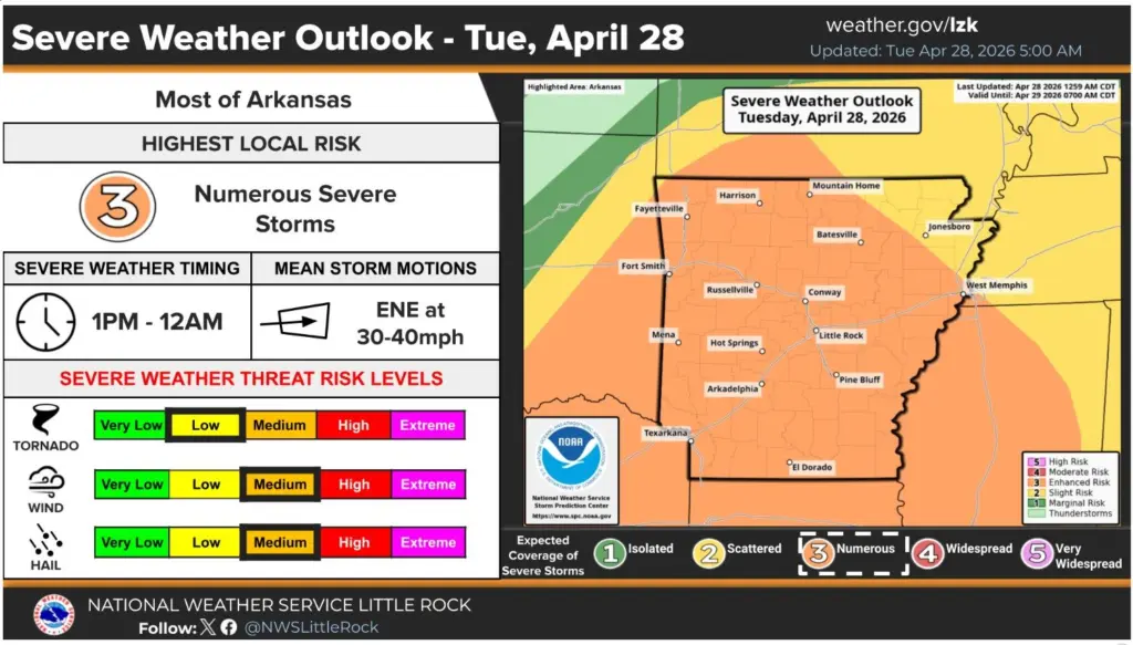
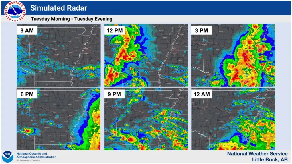
After a strong storm system battered the region in the early morning hours, more severe weather is forecast to move through on Tuesday afternoon.
Most of north-central and northeast Arkansas are under a severe thunderstorm watch until 6 p.m. The National Weather Service in Little Rock reports that strong to severe storms are expected this afternoon and evening, with some potentially lingering into the early overnight hours.
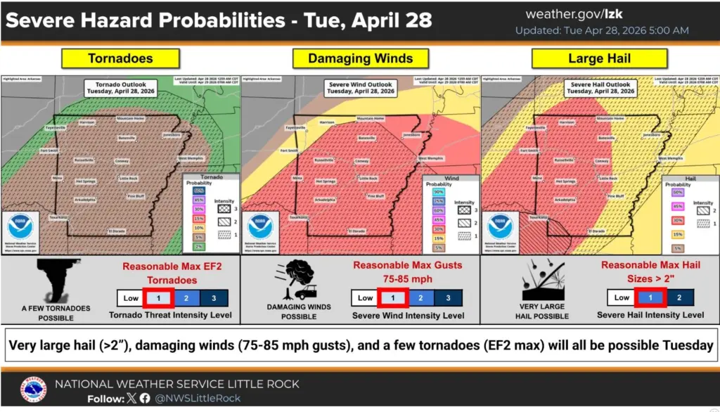
Forecasters say the primary threats are hail and damaging winds, though a few tornadoes are possible. The storms could produce hail larger than 2 inches, wind gusts of 75 to 85 mph and tornadoes up to EF2.
A cold front will push through the state Tuesday night, shifting winds to the north and northwest and bringing cooler, drier air. High pressure is expected to keep the state dry through at least Thursday, with rain chances returning next weekend.
Be sure to keep it tuned to the White River Now family of radio stations, on-air or online, for the latest severe weather information.
Have a news tip or event to promote? Email White River Now at news@whiterivernow.com. Be sure to like and follow us on Facebook and Twitter. And don’t forget to download the White River Now mobile app from the Google Play Store or the Apple App Store.
Get up-to-date local and regional news/weather from the First Community Bank Newsroom on Arkansas 103.3 KWOZ every weekday morning and afternoon. White River Now updates are also aired on weekday mornings on 93 KZLE, Outlaw 106.5, and Your FM 99.5. Catch CBS News around the top of every hour on 1340 KBTA.